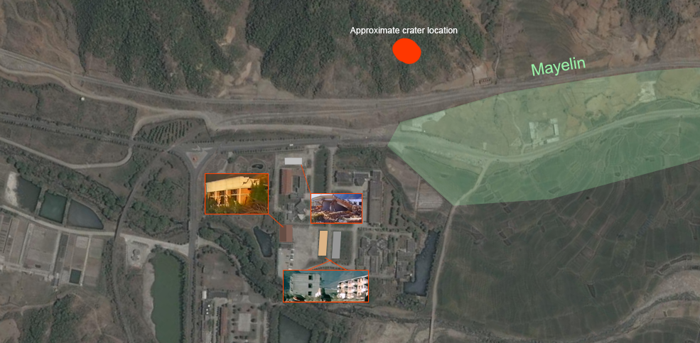
crashsite of I708
the long march 3b carrying intelsat 708 began leaning towards the umbillical tower approximatelly 2.0 seconds after initial liftoff. 4 seconds later it was already over the tower, and 6 seconds later it was essentially out of the launch area. 22 seconds later it crashed into a hillside located 210,61 meters (21.061 km) away from the Coordination building and 1919,88 meters (191.988 km) away from launchpad 2. the explosion had the magnitude of 55 tons of TNT and annihilated the Mayelin village.
but where exactly did it crash? on this page i will attempt to map out and explain the exact crashsite of I708, the location of Mayelin village, and much else
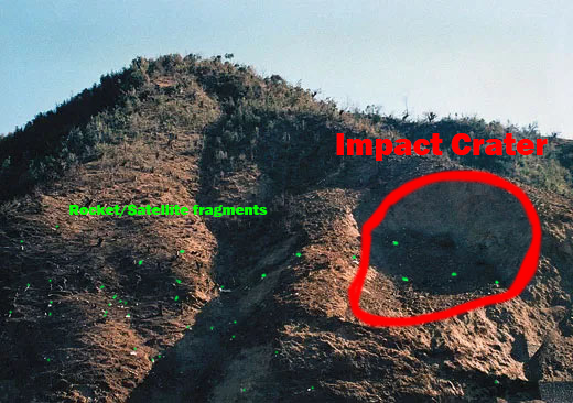
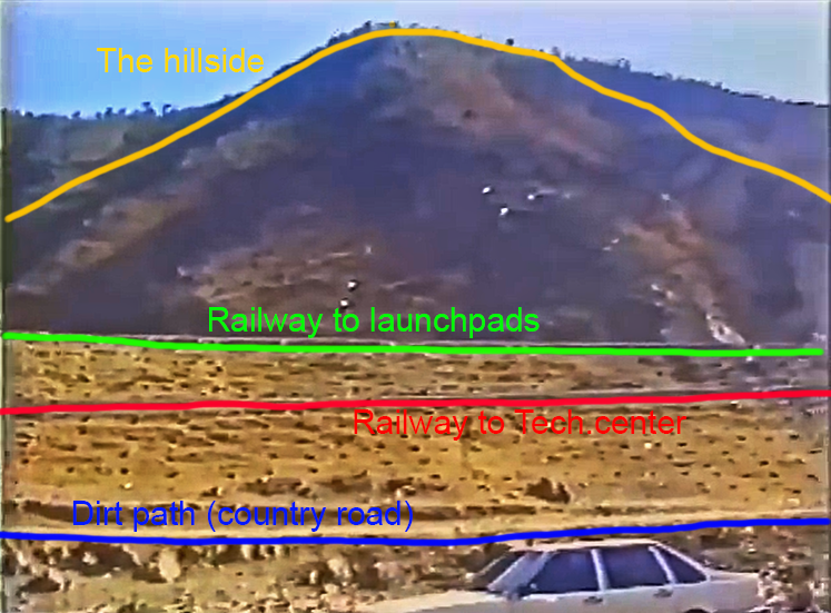
first of all, where exactly did the rocket crash on that hillside?
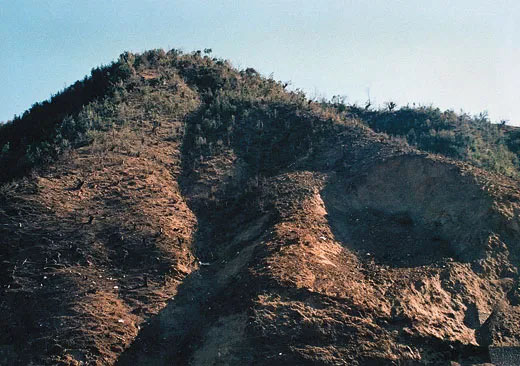
its not really clear where the crater was exactly located on that hillside, however the amount of footage currently avaible that shows the hillside, and especially a photo taken by Bruce Campbell help quite alot in understanding the craters approximate location
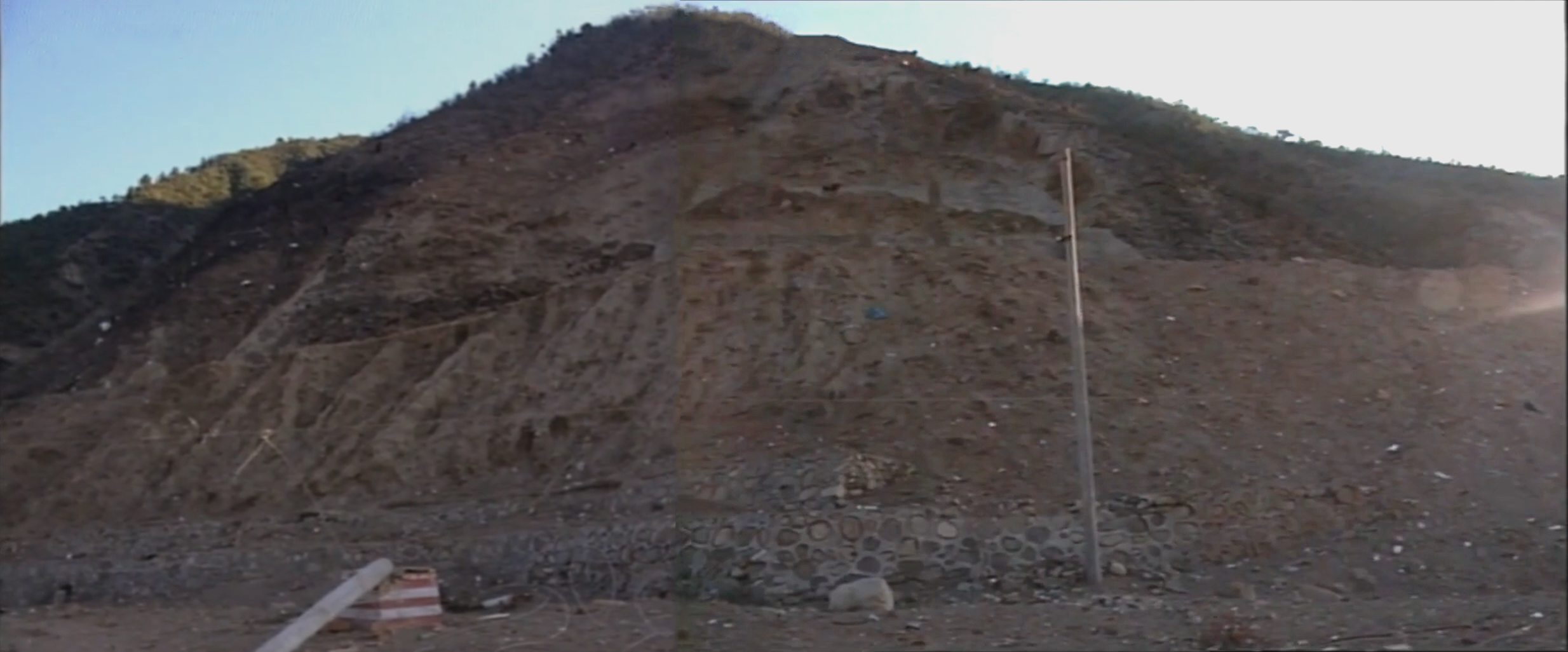
the 2 pictures i provided is a panorama of the hillside made by me and Bruce Campbells picture of the hillside (notably lower in quality and size than the panorama)
the impact crater seems to be located to the far-right of the hill, on the descending part of it (especially noticable on Campbells picture).
google earth shows the approximate distance from the crater to the cord.building as 210,61 meters (21.061 km), which is not entirely the correct distance since thats the distance from the supposed crater position
under the hillside is a slope, on which 2 railroads are located, both leading from manshuiwan to the technical center of XSLC and the launchpads. a country road for the locals is located under the railway slope. if the impact was on either of these paths then the nearby structures would probably be vaporized by the shockwave, not even talking about the nearby village
nearby structures
the Coordination building, used by the Chinese engineers of the launch center as both a dormitory and office, essentially only had its facade standing due to it directly facing the crater. the cord.building is located in the residential area, which is located at the main gate of the launch center, surrounded by hills from the south and north (including the impacted hillside).
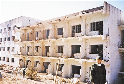
pictured above is an image of the building after the crash. notice the broken window frames and cloth hanging out of windows.
below the hillside, slightly to the left of it is the main gate of the launch center, which consists of 3 buildings and the gate. a guard was in there during the launch. he was launched into a pond and miracuosly survived the disaster. the buildings at the main gate had some of the paint fall of and had only the facades remain, however surprisingly the gate itself seems to not have been even scratched.
the village of Mayelin (not to be mistaken with the town of Mayelin, located to the east of XSLC, which still exists) was located right at the main gate of the launch center. it was the village that essentially got vaporized due to it being in close proximity to the crashsite of i708
miscellaneous maps